
1. Get the forecast
BEFORE THE TRIP

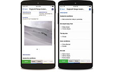
The avalanche forecast is divided into three parts: the danger rating, the avalanche problems and the details section. Reading the forecast for a few days leading up to your trip will give you an idea of how conditions are evolving. On your travel day, focus in on the danger ratings for the elevation zones you’ll be exposed to. Also, make sure to note which avalanche problems exist and where you’ll expect to find them.
Dig deep: what if there's no forecast?
The Dangerator
Avalanche forecasts are available for several, but not all, mountainous regions of Canada. Avalanche Canada has developed the Dangerator, a tool to estimate the avalanche danger outside established forecast regions. Whether you are planning an expedition to Mount Logan in the Gaspé, the Saguenay, the North Shore or anywhere else in Quebec, you can use this decision-making tool on the morning of your trip to incorporate the most recent observations. The Dangerator guides you through a process that allows you to obtain an approximate danger index, based on weather conditions and your own observations. You can purchase a Dangerator booklet (French only) from our online store, or you can save the digital version free of charge.
Check this video to learn how to use it: